
Alluvial terrains
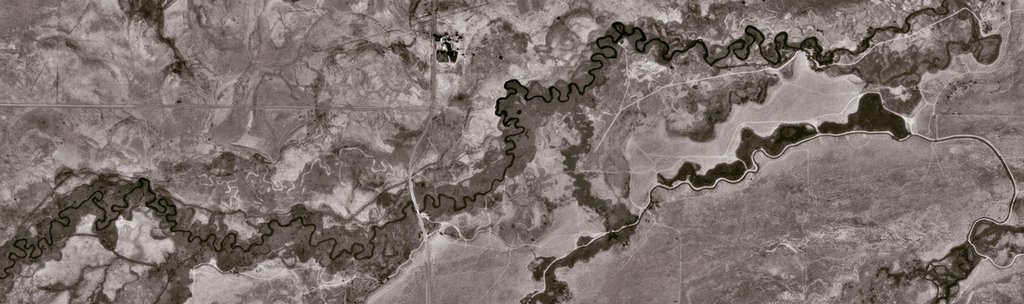
A composite of riverine meanders, ancient hydrological scars in the earth of California, Owens Valley, like glimpses of old Chinese landscape scrolls –
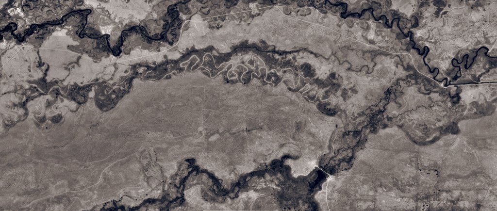
– taken from the satellites of TerraServer. Fossilized wakes and side-streams, eroding banks of fractal continents. Silt on silt. Everything ending in self-similarity.
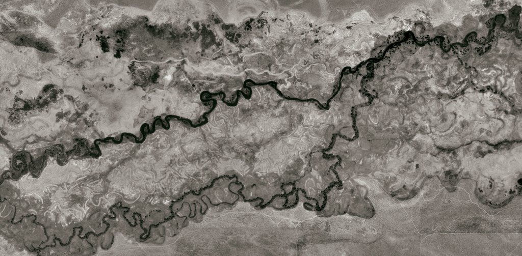
Click-on to enlarge! Please!
Meanwhile, see Pruned's uploaded set of geological investigations from the lower Mississippi alluvial basin.


Comments are moderated.
If it's not spam, it will appear here shortly!
These would make amazing bookmarks, if there are any designer-printers out there reading BLDGBLOG... If so, be in touch!
Dude, if you like pictures like these, you gots to check out Alaska. Google maps, yo.
Will do.
Meanwhile, the originals of the above images are more than a foot wide, and I'm still in awe. If you go to the TerraServer page I link to up there and kind of click around, to the west, you'll find the dried-up remains of Chinatown's Owens Lake. Remnant waterforms. Spectral inland seas. I think hydrology is possibly the most interesting force on the planet right now. If it was up for the NFL draft, it'd be quarterback. Hydrology : the planet :: Vince Young : NFL.
Sort of related: Geological Investigation of the Alluvial Valley of the Lower Mississippi River, Part IV via http://infosthetics.com/
Yeah, those Infosthetics maps came from Pruned, which are linked in the above post. But thanks!
Post a Comment