
Quick Links 11
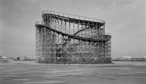 [Image: A fun-ride isolated amidst its paved surroundings, by Christoph Morlinghaus].
Some quick links for a Wednesday afternoon:
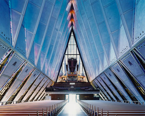
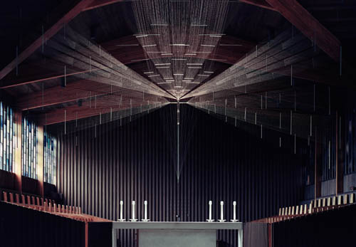
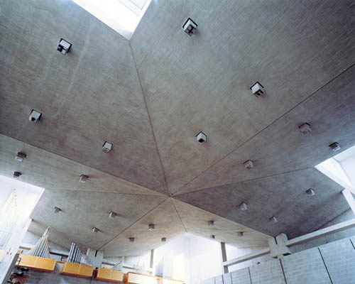
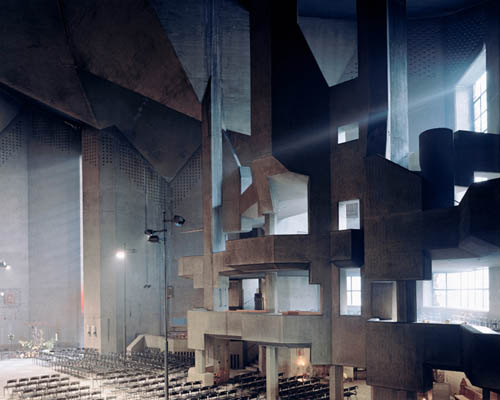
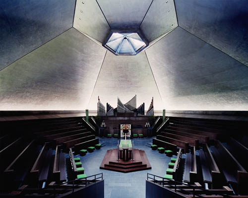
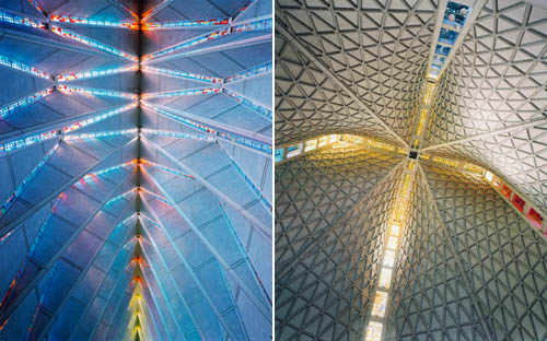
1) Photographer Christoph Morlinghaus's work is fantastic. His well-patterned explorations of the parking lot sublime are well worth checking out, as are his remote desert landscapes, snow-accentuated mountain peaks, and vast greenhouses. However, his explicitly architectural photography is how I first discovered—and became a fan of—his work, including these amazing shots of Saarinen's TWA terminal; but it's these unforgettable glimpses of church interiors that really stun me, perhaps even visually demonstrating that contemporary Christianity and science fiction come together in the Venn Diagram of architectural speculation. 2001 meets the Ascension. (Originally spotted via the excellent blog but does it float).
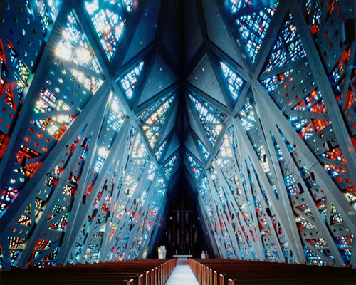 [Image: Photo by Christoph Morlinghaus; contact the artist].
2) I've already linked to the extraordinary story of "Richard Préfontaine and his wife, Lynne Charbonneau, [who] were watching a playoff hockey game with their two daughters on Monday night when the ground beneath their house gave way suddenly and without warning." But were "very recent tarmac repairs extending right across the road" nearby, including "other hairline cracks" visible for weeks in the paving, signs of this impending collapse? "It may well be that [the] slide was creeping prior to final collapse," we read—and this "creeping" of the earth was visible in the form of patchwork road repairs taking shape outside. Amazingly, the New York Times adds, "the family’s shocking demise was a stark reminder of a hidden menace under many parts of Quebec, one that dates back 10,000 years to an ancient inland sea." (Thanks to Brian Romans for the road-repairs link!)
 [Image: Photo by Christoph Morlinghaus].
3) Using an eye-popping series of satellite images, geologist Michael Welland explains that "barrier islands are amongst the most dynamic and ephemeral natural landforms on the planet"—and thus a major reason why Louisiana's plan for the "dredging and construction of eighty miles of six-foot sand berms along the coast on either side of the Mississippi Delta as protection against the oil spill" unleashed last month by BP is all but functionally impossible.
 [Image: Photo by Christoph Morlinghaus].
4) Speaking of oil spills, I've been enjoying the Twitter feed @BPGlobalPR.
5) systemic explores the imaginative allure of remote Pacific islands and the astronomical possibility of "habitable worlds."
 [Image: Photo by Christoph Morlinghaus].
6) Recent architecture grad Nick Sowers—congrats, Nick!—has posted several fantastic back-to-back posts: one, on the "American Military Pastoral"—or the overseas U.S. military base as preserved landscape—another a long, swirling, metafictional look at what Nick calls "Military Speleology," the "jet noise barrier" of passing American warplanes on Guam, and "the production of new faults" in the island's bedrock when these thunderous sonic booms help to destabilize the earth's interior. Creating caves through sound. There's also an archaeological report exploring future speculative excavations, and a forensic inquiry: "How is ruination measured and tracked?"
 [Image: Photo by Christoph Morlinghaus].
7) Middle Savagery asks "if any architecture has been inspired by archaeology"—specifically, "how would you construct a building explicitly to excavate it?"
 [Image: Photo by Christoph Morlinghaus].
8) Participants in the speculatis workshop will use "advanced modeling techniques and fabrication technologies" to explore "lighting systems and their possible interaction with user movement." That is, you'll be designing an interactive chandelier. Apply by 15 June for this weeklong workshop in Oporto, Portugal, held 10-17 July 2010. And then send in images of whatever you produce there!
9) The 3rd Coast Atlas "is a platform for research and design initiatives that explore the urbanization, landscape, infrastructure and ecology of the Great Lakes Basin and Great Lakes Megaregion." Submissions are due 31 August 2010.
 [Image: Photo by Christoph Morlinghaus].
10) Friends of the Pleistocene are embarking on a tour along the ancient shores of Lake Bonneville, the partially vanished megalake that once spanned the entire Great Basin (and whose hydrological remnants include Utah's massive Salt Lake). They'll be "using photography, drawing, super 8 film, and GPS mapping/logging" to record their trip.
- We’ll also look for traces of lines carved by Lake Bonneville’s fluctuations in size and depth—significant enough changes to warrant their own names: Lakes Gilbert, Provo and Stansbury. Many of the lines, sometimes called benches, strand lines, and even “bath tub rings,” are clearly visible from main roads and Interstates. We’ll also go off-road in search of more remote shorelines and playas left behind by the lake.
Extra Credit: Lasers Could Create Clouds, and Perhaps Rain, on Demand.
[Post updated 28 May 2010 with more links to Nick Sowers's work, on a tip from mammoth].


Comments are moderated.
If it's not spam, it will appear here shortly!
Link #2: a tragic way to die. Ironic? Their dog, tied up outside (in nature), survived.
Post a Comment