Beginning at Arcs, Centered by Lines

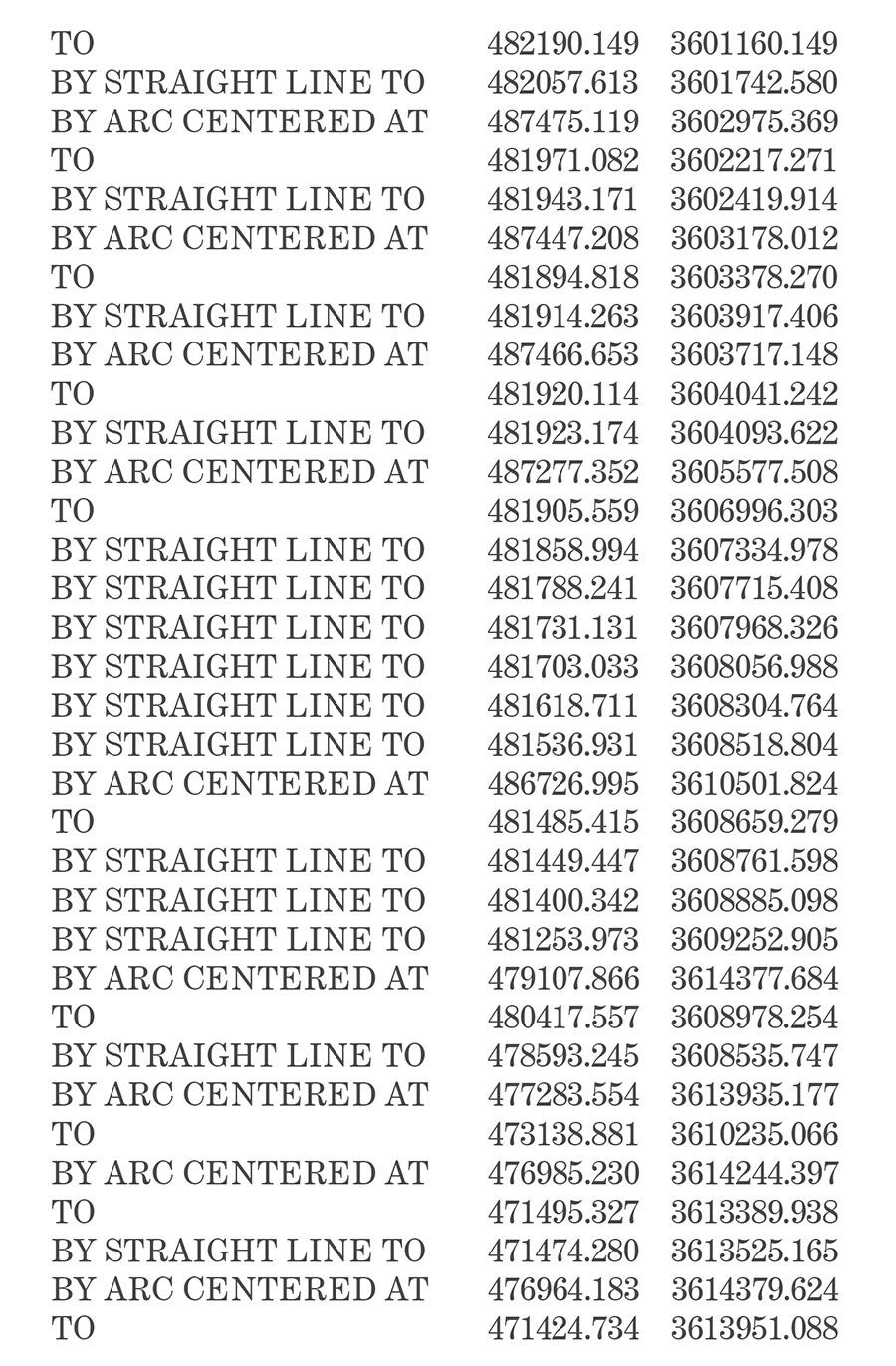
[Image: From United States of America, Plaintiff v. State of California,” December 15, 2014].
This is old, old, old news, widely covered elsewhere at the time, but I rediscovered this link saved in my bookmarks and wanted to post it: back in December 2014, the U.S. Supreme Court redefined the maritime border of California with an amazing, 108+ page sequence of numerical locations in space.
It is geodetic code for marking the western edge of state power—or Sol Lewitt’s instructional drawings given the power of sovereign enforceability.
Rather than “The Location of a Trapezoid,” in other words, as Lewitt’s work once explored, this is the location of California.

[Image: From United States of America, Plaintiff v. State of California,” December 15, 2014].
Beyond these mathematically exact limits is not the open ocean, however, but sea controlled by the United States federal government. The coordinates laboriously, hilariously reproduced over dozens and dozens of pages simply define where California's “Submerged Lands” end, or expanses of seafloor where California has the right to explore for economic resources. Outside those submerged lands, the feds rule.
In a sense, then, this is the Supreme Court seemingly trolling California, tying up the Golden State’s perceived western destiny within a labyrinth of constricting arcs and lines, then claiming everything that lies beyond them.


Comments are moderated.
If it's not spam, it will appear here shortly!
Post a Comment